A New Era in Environmental Research
Imagine standing by a river, watching as a drone hums overhead. Below, its lidar system scans the landscape, mapping both the land and the shallow waters with pinpoint accuracy.
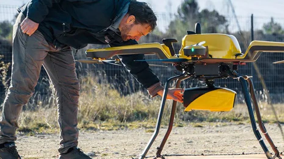
This is precisely what YellowScan's new Navigator system is designed to do. Built specifically for mapping underwater topography in rivers, ponds, and coastal areas, the Navigator is changing the game for environmental monitoring.
Transforming Environmental Research
YellowScan emphasizes that the Navigator is a critical tool for addressing climate change impacts and advancing environmental research. Its applications include:
- Tracking coastal erosion and sediment movement: The Navigator provides centimeter-level precision in mapping shorelines, enabling researchers to model erosion patterns and sediment transport more effectively.
- Monitoring underwater biodiversity habitats: By capturing detailed 3D images of underwater ecosystems, the Navigator allows scientists to assess habitat volume and spatial distribution.
- Assessing coral reef degradation: The system's ability to map reefs in high resolution helps researchers monitor changes in coral health over time.
- Evaluating sea-level rise impact zones: The Navigator enables precise mapping of low-lying coastal areas at risk from rising sea levels.
- Documenting changes in marine ecosystems: With its advanced lidar technology, the Navigator captures temporal changes in marine environments, offering insights into how human activity and climate change are reshaping aquatic ecosystems.
A Powerful Tool for a Sustainable Future
YellowScan highlights the Navigator's potential to make a significant impact across various sectors. In environmental research, it enhances data collection, leading to more accurate environmental assessments. For marine conservation, the Navigator offers tools to better monitor and protect delicate marine ecosystems.
When it comes to coastal protection strategies, it plays a crucial role in developing effective measures to combat erosion and flooding. The system also helps in climate migration planning by identifying vulnerable areas, enabling more informed decision-making. In infrastructure development, the Navigator aids in efficient planning by providing detailed spatial data.
A Game-Changing Investment
YellowScan hasn't shared exact pricing for the Navigator yet, but given its advanced tech and precision, you can expect it to be a significant investment. That said, the long-term benefits, like better efficiency, lower operational risks, and unmatched data accuracy, make it a smart choice for anyone in environmental research, infrastructure planning, or marine conservation.
For those interested, it's best to reach out to YellowScan directly for custom pricing info.
A Leader in Environmental Research
YellowScan CEO Tristan Allouis says, "Years of development and distillation of knowledge were necessary to create YellowScan Navigator. This technology is transforming abstract climate change discussions into concrete, measurable data."
At the end of the day, the YellowScan Navigator isn't just another fancy gadget; it's a game changer for environmental research.
What's Next?
If technology can now map the unseen depths of our waterways with precision, what's stopping us from taking stronger action to protect them? The future of our planet depends on it. Let's work together to make a difference.